FPV interceptions of Russian UAV : statistics, map, analysis.
The Ukrainian Defense Forces intercepted more than 850 drones of the “fixed-wing” type.
In a first for modern warfare, the Ukrainian Defense Forces have been using FPV drones to intercept Russian drones. In recent months, a variety of published sources have included video evidence showing the considerable success Ukraine has had in doing so. This article examines aggregated open-source data on interceptions of Russian “fixed-wing” drones.
As a disclaimer, all materials used in this article have been meticulously collected from open sources, solely for the purpose of researching UAV interceptions. The offline map, table, video, and photographic materials are attached to this article with their own separate link. For those who wish to conduct further monitoring and fact-checking of this topic, please reference either source links or specific points in this article’s materials as a source.
The mechanism of countering enemy UAVs of the “fixed-wing” type using FPV interceptors is not as challenging to understand as one might initially perceive. If we were to omit the stages which precede any interception, such as detection, target designation etc, we arrive at the event shown within video and single image souces, of an FPV interceptor approaching the enemy drone and disabling it by either detonating a warhead or knocking it out of the sky by ramming it.
The vast majority of interceptions occur with the detonation of the warhead. In this case, objective control is challenging since, along with its target, the FPV interceptor is also destroyed in any successful engagement.
Therefore, we further assume that each FPV interceptor approach to the enemy drone results in a successful engagement.
At the date of this research article’s publication, 870 interceptions had been processed, with an expected share of unfiltered duplicates accounting for no more than 2%. It should be noted that this study does not include examples and video footage of Russian FPV interceptions; we note that the presently recorded ratio is 870:8 in this regard.
The individual parameters of this research’s recorded statistical data are herein grouped into two categories: ‘reliable’ and ‘requiring additional assumptions’.
Of the 870 hits, 766 (88%) are day cameras, and 104 (12%) are thermal cameras.
The following parameter relates to the model of the downed UAV. Please note that the Supercam/Scat models are visually similar and are not classed as distinct within analysis of this research’s video sources, with the use of “Supercam” being routine amongst operators to describe both of these models. Similarly, the various versions of the Lancet are not differentiated herein, although these UAV models differ visually. We have, therefore, proposed a categorization that we consider optimal. In addition, these models can be further categorized into either ‘reconnaissance’ or ‘strike’, with 11 reconnaissance models and 3 strike models, of which 850 and 20 were intercepted, respectively. Attentive reader might notice that some models do not belong to the “enemy” UAV category, we have included Hawk and Furiya because they were also intercepted by the UDF.
(tässä oli kuvia kustakin torjutusta dronesta - kannattaa vilkaista alkuperäisestä artikkelista jos kiinnostaa)
There exist significant delays between any individual engagement and the publication date of them as visual sources. Even using satellite images, it has proven impossible to reliably determine the actual date of any given engagement. The following chart illustrates the date of publication given by the open source information. One of the first priorities is to look at the ratio of quantity against time. It is advisable to refrain from overly relying on this detail of the data because the processed 870 interceptions came from only 279 publications, of which 158 contain videos of a single, individual interception each video. The number of “video compilations” is significant, which can distort the losses’ statistics in relation to time.

The following table specifies the unit to which an engagement is attributed, totalling 53 units of the Ukrainian Defense Forces and 3 groups of unidentified units, and the quantitative data from the leading 13 individual units that either published the interception’s video source or were credited in its description.
The tactics involved in using UAVs as interceptors are not as yet either publicly available or possible to ascertain from open source data, but it can be determined that the UAVs involved are used in pairs. Videos of objective control of interceptions filmed by the camera of the second Ukrainian drone have been published several times. Interestingly, the tactics involved can be seen to have been effective in countering the maneuvering of enemy reconnaissance UAVs (
https://mil.in.ua/en/news/russian-uavs-begin-to-maneuver-away-from-threats/), as well as possible future trends in countering FPV interceptors, such as net shooters.
The distribution of hits by regions (Oblasts) evidences where places seeing intensive combat also see a high density of enemy drone hits. You can see all the interceptions clearly and in detail on the map:
https://map.ukrdailyupdate.com/?lat=49.239121&lng=30.761719&z=6&d=20049&c=1&l=0&ls=dro&dls=cur. All the hits that could not be reliably geolocated to date have been placed on the map in Kyiv; their location there being a temporary technical convention. In order to display all placemarks, make sure you have enabled setting “Marker Stacking”.
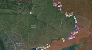
For clarity, this article shows parts of the map not labelled using the administrative borders of Ukraine’s individual regions. Instead, we have chosen to show the clusters of interceptions based on the names of frontline cities. Accordingly, we result in 10 clusters, which are named and illustrated below. There are several reasons for this clustering: the level of hostilities compared to the recorded activities of enemy reconnaissance UAVs. The location of media-active units is a known variable, so it is possible for us to see the results of their combat work from open sources. Interceptions in “unusual” places are more challenging to geolocate. Such a video interception is hence more likely to be marked as difficult to geolocate.
(tässä oli suuri määrä yllä näkyvän kaltaisia karttakuvia joihin oli merkitty torjunnan geopaikannus eri alueiden osalta - jätän ne pois tästä mutta kannattaa vilkaista alkuperäisestä artikkelista)
Three points that we managed to see while working with the map that seemed interesting to us :
1. Published interceptions of Russian drones occur over the gray zone or over the territory controlled by the Ukrainian Defense Forces. It is extremely rare that we observe an interception that happened behind the front line in temporarily occupied territory.
2. Using the example of cluster 8 at Vovchansk, note that interceptions of Supercam drones are within the city limits or along the roads. In the same area, FPV interceptors destroy Zala drones south of the city. We observe that Zala drones, on average, are intercepted at a greater rate than Supercam drones. This observation holds consistent throughout all other clusters.
3. Local observation of Lancet drones west of the city of Sudzha, cluster 10 Volfyne-Pogrebki-Sudzha. Out of 14 known interceptions of drones of this model, 7 interceptions were carried out in this area. Two conclusions could be drawn from this particular observation. The first is that the Russians have flown more Lancet drones in this area and Ukraine have maintained a constant level in the efficacy of their interception rates. The second, that Ukraine’s interception rates have increased, while number of Lancet drones deployed remained unchanged. A combination of the two previous results may also be possible.
This article’s aggregated, albeit limited, information confirms the effectiveness of projects from the CF Povernys Zhyvym “Dronopad” and the Serhiy Sternenko Community “Sky Rusoriz”. From the outset, our idea was to collect statistics for the purposes of a comprehensive project, but this proved difficult because there were cases when these two projects contributed to the same interception events. The projects sometimes provided different data sets relating to interceptions for the same unit.
Returning to the ratio given at the beginning of the article, we see that the number of interceptions by the SOU is hundreds of times higher than the number of enemy interceptions. This is attributed to the rapid and coordinated actions of all participants in this process. To ensure further advantage over the enemy, benefactors and patrons should consider making monetary donations to the following specified accounts or to other certified addresses of these projects:
“Dronefall”:
https://send.monobank.ua/jar/7VuHWj7Eyx
“Sky Rusoriz”:
https://send.monobank.ua/jar/dzBdJ3737
This article would not have been possible without significant informational support from Andrew Perpetua’s OSINT team (X:
https://x.com/AndrewPerpetua, BlueSky:
https://bsky.app/profile/andrewperpetua.bsky.social ).
You also may be interested in reading this article in Ukrainian language on Militarniy portal :
https://mil.in.ua/uk/blogs/fpv-perehoplennya-rosijskyh-bpla-mapa-statystyka-ta-analiz/
Dataset storage :
https://drive.google.com/drive/folders/1Rvdix00yeZgLAefDHWr1y8tOOCusifot?usp=sharing


 Korruptio, epäpätevyys ja strategisen vision puute johtavat valtionvastaisiin päätöksiin.
 ️ Meillä, maana ja kansana, joka maksaa erittäin korkeaa hintaa taistelusta oman vapautensa puolesta, ei ole varaa sallia tällaisten virheiden ja rikosten toistumista.
 Suosittelen katsottavaksi “Radio Svobodan” toimittajien ohjelman “Skhemy” perusteellisen tutkivan raportin siitä, miten kävi niin, että Moskova käyttää Ukrainan 1990-luvulla sille luovuttamia strategisia pommikoneita ja ohjuksia hyökätäkseen Ukrainan kaupunkeihin.
 Tämä on todella hyödyllinen ja tärkeä tutkinta. Kiitos “Skhemy”-tiimille tästä merkittävästä työstä. On hienoa, että myös Ukrainan sotilastiedustelun (GUR) tiedot, mukaan lukien venäläisistä lentäjistä – sotarikollisista – ovat olleet hyödyksi materiaalin tuottamisessa.
 Voimme voittaa vihollisen ja suojata Ukrainan luotettavasti vain silloin, kun muutumme peruuttamattomasti. Valtion edun on oltava jokaisen tärkein prioriteetti.

 Ukrainan sotilastiedustelupalvelun (GUR) johtaja, kenraaliluutnantti Kyrylo Budanov, puhui Ukraina–NATO-neuvoston hätäkokouksessa
 26. marraskuuta 2024 Ukrainan sotilastiedustelun johtaja, kenraaliluutnantti Kyrylo Budanov, piti puheen Ukraina–NATO-neuvoston hätäkokouksessa.
 Kokoukseen osallistui myös Ukrainan ilmavoimien vt. komentaja, kenraaliluutnantti Anatolii Kryvonozhko.
 ️ Ukrainan edustajat kuvasivat hyökkäyksen seurauksia, selittivät sen aiheuttamia haasteita ja uhkia euroatlanttiselle turvallisuudelle sekä luettelivat aggressorin tavoitteet, joita se pyrki saavuttamaan.
 Kokouksen aikana Kyrylo Budanov ja Anatolii Kryvonozhko vetosivat NATO-kumppaneihin vahvistaakseen Ukrainan ilmapuolustusjärjestelmää.
 Liittouman jäsenvaltioiden edustajat tuomitsivat Venäjän toimet ja vakuuttivat jatkavansa Ukrainan tukemista. He korostivat, että ainoa asianmukainen vastaus Venäjän keskipitkän kantaman ballististen ohjusten käyttöön on lisätä aseiden toimituksia, joita Ukraina tarvitsee taistelussa.

 Keskustelun jälkeen lordi Ashcroft kirjoitti artikkelin brittiläiselle Express-lehdelle, jossa hän vertasi Ukrainan ja Venäjän välistä meritaistelua Raamatun Daavidin ja Goljatin taisteluun.
 Tämän asejärjestelmän avulla GUR:n erikoisjoukot ovat onnistuneet tuhoamaan tai vahingoittamaan 15 suurta alusta ja mustanmeren laivaston sotalaivaa aggressorivaltion Venäjän joukoilta.
 Lue lisää artikkelista linkistä:


 Talven kylmyyden lähestyessä Käärmesaarilla asuvien lukuisten kissojen ja kissanpentujen elämä käy vaikeammaksi. Ukrainan sotilastiedustelun (GUR) “Timurin erikoisyksikön” taistelijat, jotka partioivat alueella, päättivät tehdä tärkeän teon – he evakuoivat 15 eläintä saarelta mantereelle.
 Kissat toimitettiin huolellisesti Ukrainan suurimpiin eläinsuojelukeskuksiin kuuluvaan “Sirius”-turvakotiin, ja pelastusoperaatio toteutettiin “Come Back Alive” -rahaston ja MacPaw Foundationin tuella.
 Esimerkiksi tänä vuonna Harkovan alueella suoritetun sotilasoperaation aikana 92. erikoisprikaatin sotilaat löysivät tuhoutuneesta talosta häkkiin suljettuja, nälkiintyneitä pöllönpoikasia. Linnut pelastettiin ja annettiin Ukrainan sotilastiedustelupalvelun johtajan Kyrylo Budanovin hoiviin. On tunnettu tosiasia, että Budanov rakastaa eläimiä – hänen kotonaan asuvat kissat Günter ja Käärme, sammakko Petro ja kanarialinnut.


